iNode®
iNode® is SMATS’ smart traffic analytics platform, integrated into Orange Traffic’s offering and powered by Floating Car Data (FCD). Through its iNode Flow module, the solution converts anonymized GPS trajectories into clear, precise, and defensible mobility insights. This continuous, high-resolution view of the network enables municipalities, MOTs, consultants, and transportation agencies to understand, monitor, and optimize traffic—without physical sensors, without fieldwork, and with full network coverage.

Description
Large-Scale Mobility Intelligence
iNode Flow measures and analyzes travel times, speeds, congestion levels, estimated volumes, Origin–Destination flows, route reliability, and network performance by hour, day, or season. This continuous intelligence helps organizations diagnose congestion, prioritize investments, plan infrastructure, and evaluate before/after impacts of projects.
Powered by Floating Car Data (FCD)
iNode leverages billions of GNSS observations collected daily, fully anonymized and aggregated. These data provide exceptional penetration rates, daily updates, up to 10 years of historical records, and spatial accuracy down to 30 meters.
A No-Infrastructure Solution
iNode removes the need to install physical counters or roadside equipment. The platform delivers reliable, representative, and cost-effective information to support:
- Traffic management and incident detection
- Transportation planning and Origin–Destination analysis
- Road safety analysis and risk modeling
- Corridor and traffic signal performance evaluation
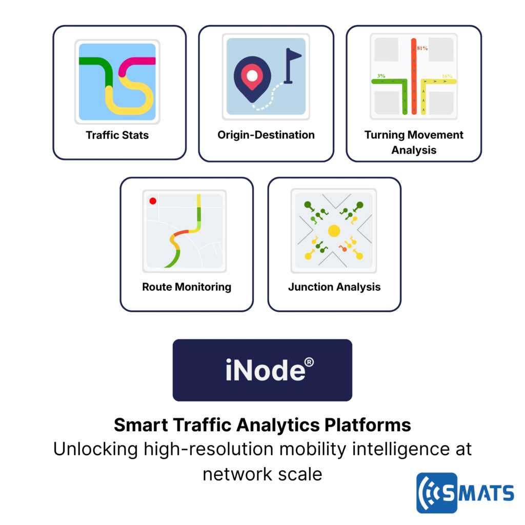
Platform Features
- Real-time map-based interface
- Automated data cleaning and processing
- Cloud or on-premise hosting
- Email or SMS alerts
- Open API for system integration
- Raw data export
- Customizable dashboards and visualizations
Measurement Capabilities (iNode Flow)
- Travel times and delays
- Speeds (average, median, percentiles, standard deviation)
- Congestion levels and profiles
- Estimated traffic volumes
- GNSS-based Origin–Destination flows
- Route reliability and variability
- Before/after analysis for projects, work zones, incidents, or weather
FCD Data Characteristics
- Industry-leading penetration rates
- Daily updates + up to 10 years of historical data
- Near real-time data delivery
- Spatial resolution down to 30 m
- Fully anonymized, aggregated, secure data

Stay
tuned!
Get information on our latest innovations, coming events and industry news